
Uncategorized
Walking route Fukuoka: Sasaguri
Come with us on a lovely forest walk in Sasaguri, Fukuoka Prefecture, on our wonderful island of Kyushu. All the information you need to enjoy this short hike is written below. The walking directions and route photos are from December 2018. We hope they

Route description
The name of the walking route is “Yamato no Mori Yuhodo” ( 大和の森遊歩道). It passes through the ancient cedar forests of Sasaguri(篠栗). Five huge cedar trees are landmarks along the trail.
It took us about 2 1/2 hours to complete this circular route. We read that it takes only about 90 minutes but you would have to rush to finish so quickly. I guess we took a bit longer because we were taking photos along the way. Anyway, what’s the point to rush?
This trail goes quite steeply up and down in some places so isn’t suitable for people with limited mobility. However you don’t have to be an Olympic athlete. As long as you are of average fitness you won’t have a problem. I wouldn’t recommend hiking on this trail if it’s raining. The paths will get muddy and slippy in the steeper places.
What if I get lost?
If you lose your way, just make your way back to the starting point: Wakasugirakuen Camping Ground. In the description below we include the Google Map location. You shouldn’t have a problem getting 4G connection. You can ask someone for directions too. It isn’t a very busy route but I guess we met 10 to 20 people walking the same path. Just show them the Japanese for for Wakasugirakuen Camping Ground – 若杉楽園キャンプ場.
How to get to the starting point
The starting point is about 30 minutes by car from Fukuoka city. It’s a pleasant drive up into the hills along a steep and winding forest road. Unfortunately there isn’t any public transport nearby. You could cycle there but the ride would be steep like hell. We did see one tough cyclist but most people arrived by car or camper van.
About the route descriptions
We tried to make the instructions (with photos) as clear as possible. It’s specifically aimed at non-Japanese speakers because there are no maps or route guidance in English. This is one of the big problems about hiking in Japan.
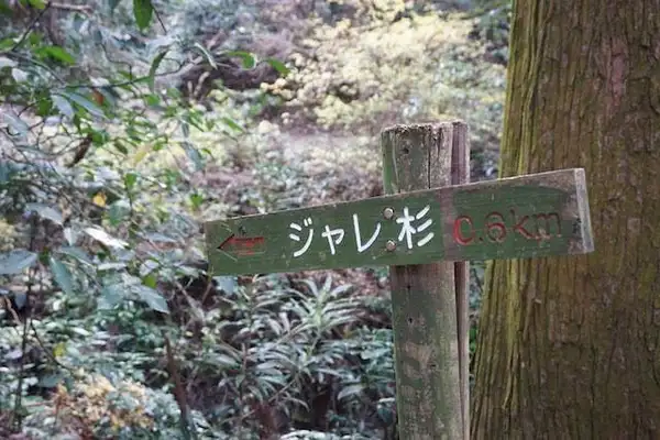
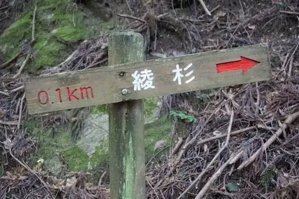
By the way, the name of each tree ends in the Japanese word ‘sugi (杉). This simply means ‘cedar tree’.
Finally, I have to mention: everything on this page is for general information only. It definitely isn’t official advice. Please take this route at your own risk. Take all necessary precautions.
Start here …
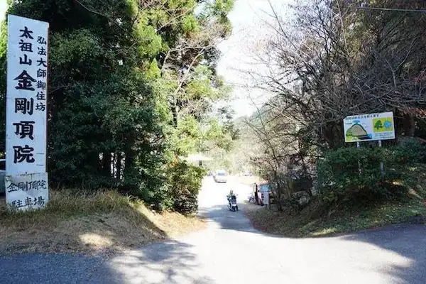
The trip starts from Wakasgirakuen Camping Ground (Google Map location). If you are driving you can input the map code 55 634 741*00 into your SatNav GPS. Photo 1 below shows the entrance to the car park and camping ground. You can camp in Wakasgirakuen Camping Ground (the clue is in the name) or park a camper van there overnight. We just used it as a car park. There is a nice view, one vending machine, some toilets, BBQ area and nothing else.
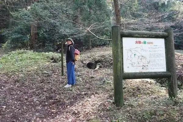
Leave the camping ground (from the entrance shown in Photo 1) and go back to the road. Go straight ahead downhill (Photo 2). Walk along the road for 100-200m until you see the signboard on the left (Photo 3). That signboard shows the walking route but of course it’s written in Japanese.

More from the blog

Kyushu Cherry Blossom Dates
Kyushu Cherry Blossom Dates 2026: latest updated 'sakura' information
READ MORE »
Japan Travel Tips
Essential info if you’re thinking of visiting Japan - check out these insider tips
READ MORE »
Kyushu Travel
Essential research for visiting Kyushu - complete list of best Kyushu travel spots
READ MORE »
Comments
Leave a comment